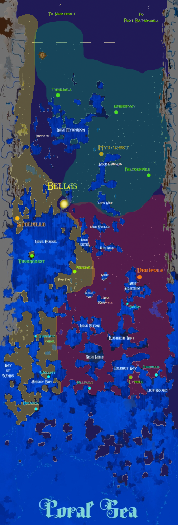
The following is an image without political borders and kinda sketchy on the land/water border within the main civilization of Vallacia, but you should be able to see how far it is from the northernmost part of the map to Northholt.
![]() by Iunnrais » 21 Jun 2012, 14:50
by Iunnrais » 21 Jun 2012, 14:50
Users browsing this forum: No registered users and 28 guests